


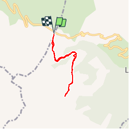

8 km | 11.6 km-effort

User


FREE GPS app for hiking
 SityTrail
IGN / Geographical institutes
SityTrail World
The world is yours!
Trail Snowshoes of 5.7 km to be discovered at Auvergne-Rhône-Alpes, Upper Savoy, La Clusaz. This trail is proposed by myjackotte.


Snowshoes

Walking
Walking

Other activity

Mountain bike
Mountain bike

Walking

Motor
Snowshoes
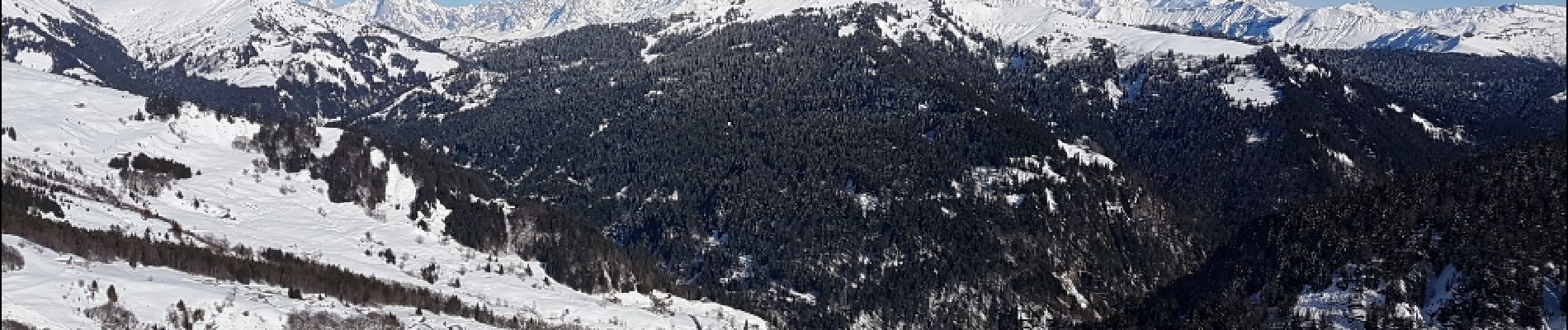
paysage époustouflant quand on découvre le mont blanc et toute la chaine montagneuse. attention couloir d'avalanche.